More than 10 years of experience
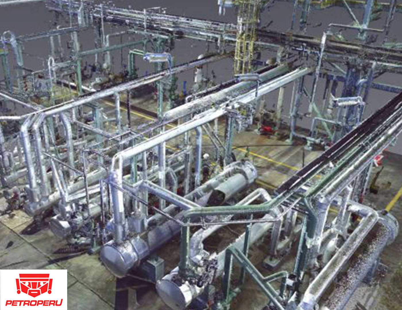
We have systematically used LIDAR phase shift scanners for more than 10 years in our industrial projects. The basic services are classic:
- Scanners and configuration according to the environments to minimize the effects of noise and artifacts and maximize security,
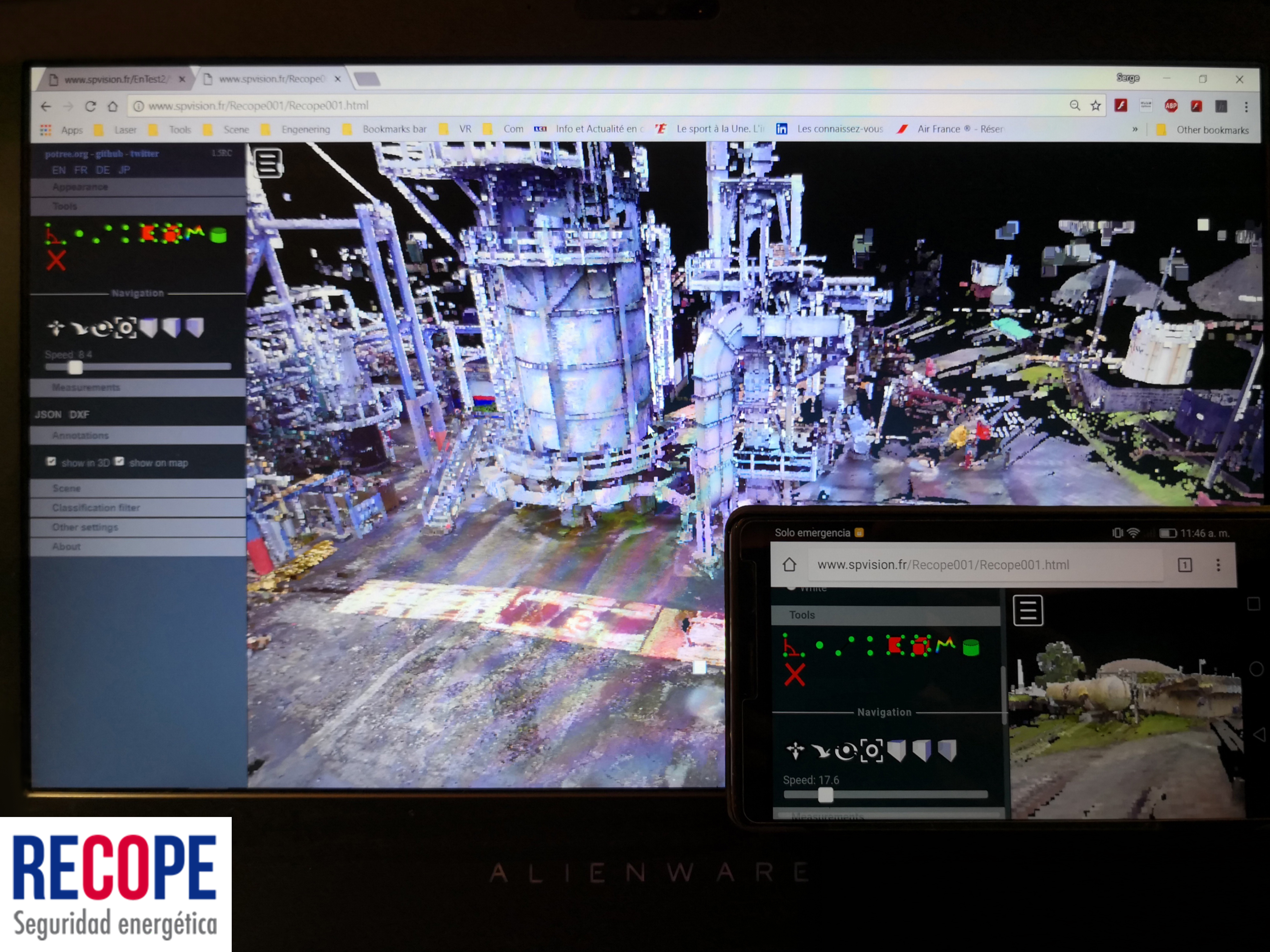
- Assembling of scanning stations, station layout plans, local or internet viewing tools
- Generation of the most common formats: ASTM E57, BIM, RCP, POD and PLY
SP VISION also performs specific laser scanning missions of pure 3D reconstruction:
- Volumetric calculations for the storage of hydrocarbons in ships,
- Simulations of routing and mounting of new equipment
- Deformation and earth movement calculations for the mining sector
- Visualization of the dilation: Scan "cold" and scan "hot"
- Heritage safeguard, archeology
Les « PLUS » SP SOUTH AMERICA
- Comparison and precision report between the scan and the model
- Segmentation by trades
- Photogrammetry: Add and mix point cloud
- Sharing the point cloud in the cloud
- Insertion of point clouds in virtual reality
- Positioning of GNSS stations and point clouds using RTK technology
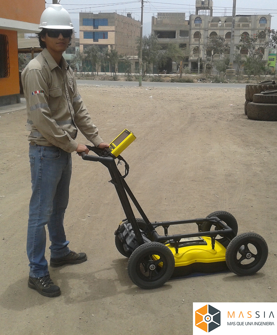
GROUND GEORADAR : FROM 0 TO -5 METERS
To complete the range "LIDAR site surveys" we use a GeoRadar which allows us up to 5 meters deep:
- To follow the paths of piping, cables and civil engineering. The plots are reconstructed in the 3D model.
- Map the basement
- Validate the absence of risks before excavation
More details on our site : www.ultrascan-tech.com
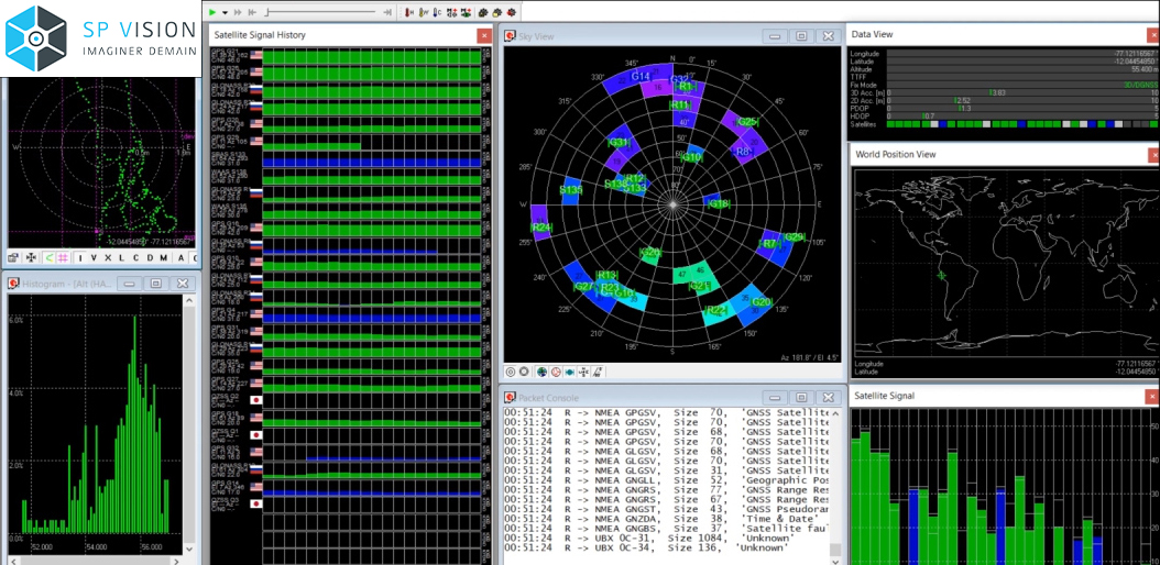
GNSS positioning
To know where we are, where you are, we use RTK technology. Our configurations use four constellations: GPS, GLONASS, BEIDOU and GALILEO as well as terrestrial relays and an “on-line” Internet service. The systems allow us to quickly get centimeter accuracy.
RTKs accompany all our missions on site, GNSS surveys are carried out on Lidar scanners, on the Georadar, on particular points in the point cloud.
The data collected is used to georeference point clouds, 3D models, topography plans and cadastral records.